Live Radar Update: Tornado Warnings & Watches – Navigating Severe Weather Safety
Hook: Have you ever felt the chilling dread of a tornado warning siren? The raw power of nature, capable of leveling homes and upending lives, demands respect and preparedness. Understanding live radar updates, tornado warnings, and watches is crucial for survival during severe weather events.
Editor's Note: This comprehensive guide to understanding live radar updates, tornado warnings, and watches was published today to empower readers with the knowledge to stay safe during severe weather. It details the differences between warnings and watches, how to interpret radar imagery, and crucial safety protocols.
Analysis: This article meticulously examines live radar data interpretation, the nuances of tornado warnings and watches issued by the National Weather Service (NWS), and the critical steps individuals and communities should take to minimize risk during severe weather. Extensive research into meteorological data, NWS guidelines, and safety recommendations has informed this guide.
Understanding Live Radar & Severe Weather Prediction
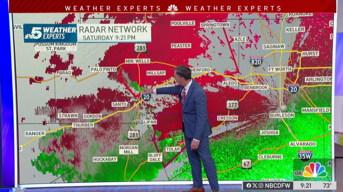
Live radar, a crucial tool in severe weather forecasting, uses Doppler technology to detect precipitation, wind speed, and direction. Different radar imagery depicts various weather phenomena. For instance, a hook echo on a radar image can indicate a rotating thunderstorm, a hallmark of potential tornado development. Other key indicators include:
- Velocity Data: Shows wind speed and direction, revealing areas of rotation and strong updrafts.
- Reflectivity Data: Illustrates the intensity of precipitation, indicating the strength of the storm.
- Storm Relative Velocity (SRV): Helps identify areas of rotation within a storm relative to the storm's movement.
These data points, analyzed by trained meteorologists, inform the issuance of tornado watches and warnings.
Key Takeaways of Tornado Warnings & Watches
| Feature | Tornado Watch | Tornado Warning |
|---|---|---|
| Meaning | Conditions are favorable for tornadoes to develop. | A tornado has been sighted or indicated by radar. |
| Action Required | Stay informed, monitor weather reports, prepare. | Take immediate shelter; seek a safe location. |
| Timeframe | Typically covers a broad area and several hours. | Typically covers a smaller area and a shorter time. |
| Urgency | Increased awareness; prepare for potential danger. | Immediate action needed; life-threatening situation. |
Tornado Watches: Preparing for the Potential
A tornado watch signifies that atmospheric conditions are conducive to tornado formation. This isn't a call for immediate action, but rather a call to preparation. During a tornado watch, individuals should:
- Monitor Weather Reports: Stay tuned to local news, weather radio, or reliable weather apps for updates.
- Review Safety Plans: Ensure family members know where to go for shelter and have practiced the plan.
- Identify Safe Locations: Locate sturdy interior rooms, preferably on the lowest floor, away from windows. Basements are ideal.
- Gather Emergency Supplies: Have a readily available emergency kit including water, non-perishable food, flashlights, batteries, and first-aid supplies.
Understanding the geographical area covered by a tornado watch is crucial. The NWS issues watches for large regions, meaning the entire area is not necessarily at imminent risk. However, preparedness is essential as conditions can rapidly deteriorate.
Tornado Warnings: Immediate Action Required
A tornado warning indicates that a tornado has been sighted or is strongly indicated by weather radar. This is a life-threatening situation demanding immediate action. When a tornado warning is issued for your area:
- Seek Immediate Shelter: Move to a designated safe location, preferably a basement or an interior room on the lowest floor, away from windows and exterior walls.
- Stay Informed: Continue monitoring weather updates for any changes to the warning's area or duration.
- Protect Yourself: Cover your head and body with blankets or mattresses if possible.
- Avoid Windows: Stay away from windows and glass doors.
- Mobile Homes: Evacuate mobile homes immediately. These structures offer little protection against tornadoes.
Interpreting Live Radar Data: A Deeper Dive
While the NWS provides crucial warnings and watches, understanding the basic principles of live radar data can enhance situational awareness. Several key features on radar images offer valuable insights:
- Rotation: A hook echo, as mentioned earlier, is a strong indicator of rotation within a thunderstorm, often preceding tornado formation.
- Hail: Radar can detect the size and intensity of hail, crucial information for assessing storm severity.
- Storm Motion: Understanding the storm's movement helps predict its path and the areas at greatest risk.
- Storm Structure: The overall shape and structure of the storm on radar can indicate its intensity and potential for producing tornadoes.
Access to live radar imagery is readily available through various sources:
- National Weather Service (NWS) Website: Provides comprehensive radar data and forecasts.
- Weather Apps: Numerous mobile apps offer real-time radar, warnings, and alerts.
- Local News Websites and Television: Most local news stations provide live radar coverage during severe weather events.
The ability to interpret radar imagery in conjunction with warnings and watches significantly enhances one's capacity to react appropriately to severe weather threats.
Spotter Networks and Community Preparedness
Community involvement plays a vital role in tornado preparedness and response. Trained storm spotters, working in conjunction with the NWS, provide real-time ground observations of severe weather, supplementing radar data. Their visual confirmation can be critical in verifying tornado touchdowns and guiding emergency responses.
Community-based emergency preparedness initiatives, including drills and educational programs, are essential in fostering a culture of safety. These initiatives should cover:
- Communication Protocols: Establishing clear communication channels during severe weather events.
- Evacuation Routes: Pre-planning evacuation routes and designated safe zones.
- Mutual Aid: Organizing community support networks for post-tornado assistance.
Beyond the Immediate: Recovery and Resilience
The aftermath of a tornado can be devastating, requiring significant time and effort for recovery. Effective community preparedness extends beyond immediate response to include:
- Damage Assessment: Conducting thorough damage assessments to prioritize recovery efforts.
- Resource Allocation: Efficiently distributing resources, including emergency aid, housing, and medical assistance.
- Long-Term Recovery: Supporting long-term recovery initiatives, including rebuilding homes and infrastructure.
Frequently Asked Questions (FAQs) about Tornado Warnings & Watches
Introduction: This section addresses frequently asked questions about tornado warnings and watches.
Questions & Answers:
-
Q: What's the difference between a tornado watch and a warning? A: A watch means conditions are favorable for tornadoes; a warning means a tornado has been sighted or indicated by radar.
-
Q: How long does a tornado warning typically last? A: The duration varies, but warnings typically last for a short period, often covering only a small geographic area.
-
Q: Where is the safest place to be during a tornado? A: A basement or an interior room on the lowest level of a sturdy building, away from windows.
-
Q: What should I do with my pets during a tornado warning? A: Bring pets inside to your safe location. Their carriers or crates should be placed under a heavy object.
-
Q: Are mobile homes safe during a tornado? A: No. Evacuate immediately if you live in a mobile home.
-
Q: What should I do after a tornado has passed? A: Check for injuries, contact emergency services if needed, and follow post-tornado safety guidelines.
Summary: Understanding the distinction between watches and warnings, interpreting live radar data, and having a robust safety plan are crucial for mitigating the risks associated with tornadoes.
Tips for Staying Safe During Tornado Season
Introduction: These practical tips can significantly improve your safety during tornado season.
Tips:
- Develop a Family Plan: Establish a clear communication plan and designated shelter locations.
- Stay Informed: Regularly check weather forecasts and alerts.
- Invest in a Weather Radio: A NOAA weather radio provides crucial alerts, even during power outages.
- Know Your Surroundings: Identify potential hazards in your area, such as weak structures or areas prone to flooding.
- Practice Your Safety Plan: Conduct regular drills with your family to ensure everyone knows what to do.
- Be Weather Aware: Pay close attention to weather changes. Dark, greenish skies, hail, and loud roars can be indicators of a tornado.
- Report Suspicious Weather: If you see anything that looks like a tornado, report it immediately to local authorities.
- Have a Go-Bag: Prepare an emergency kit with essential supplies including water, food, medications, and flashlights.
Summary: Implementing these safety measures increases preparedness and improves chances of survival during a tornado.
Summary of Live Radar, Tornado Warnings & Watches
This article provided a detailed examination of live radar technology, the critical differences between tornado watches and warnings, and comprehensive safety protocols for navigating severe weather. Understanding and applying this information is paramount for safeguarding lives and minimizing damage during tornado events. Continuous monitoring of weather reports, preparation of emergency plans, and immediate response to warnings are essential elements of personal and community safety.
Closing Message: The unpredictable nature of tornadoes underscores the importance of ongoing preparedness. By staying informed, planning strategically, and responding swiftly, communities and individuals can significantly reduce the devastating impact of these powerful weather events. Investing time in preparedness is an investment in life.

